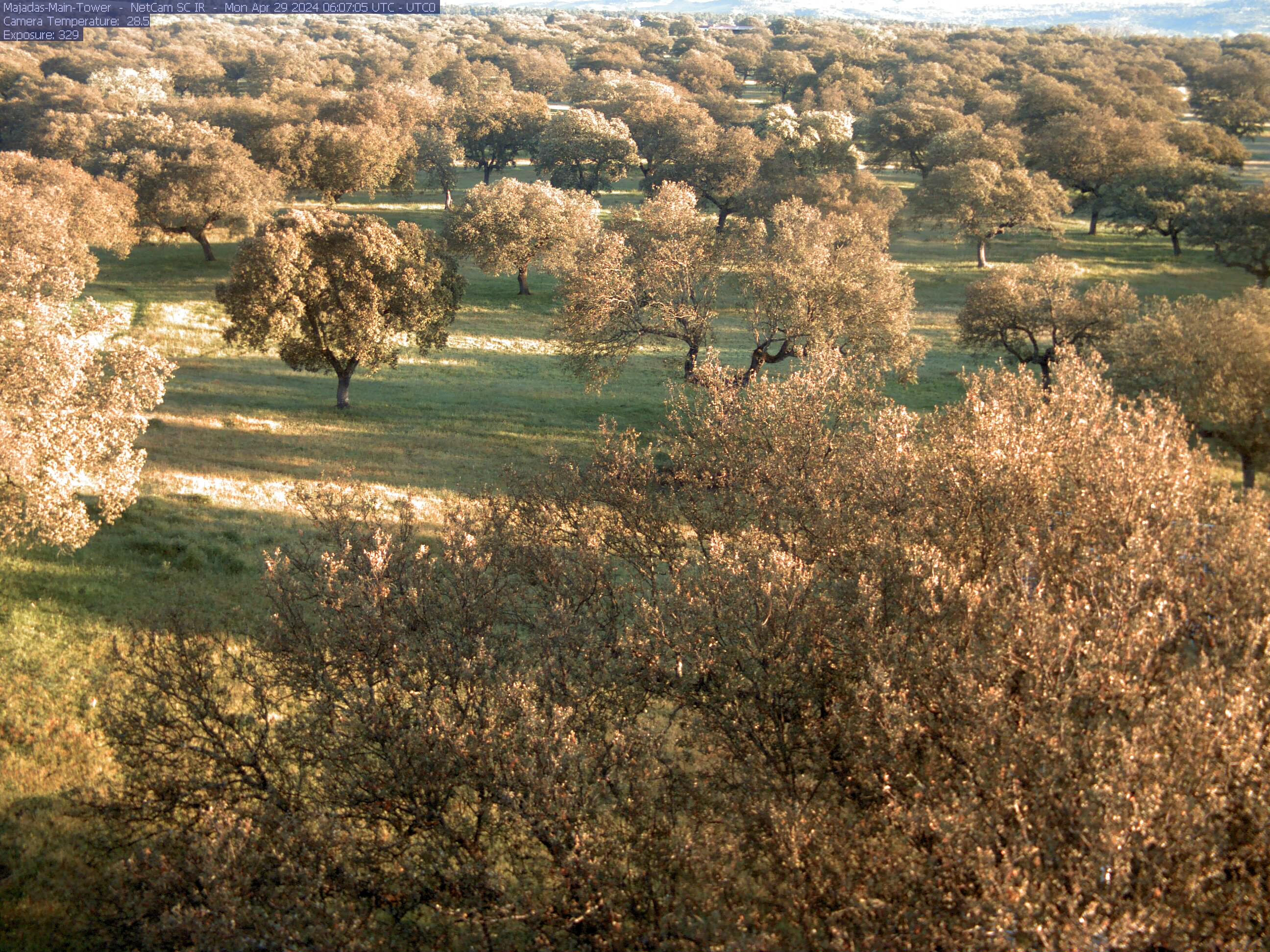

Since 2003, the CEAM operates an experimental station located in the Dehesa Boyal of Majadas de Tietar (Caceres, Spain). The station is located in a typical dehesa from Extremadura, a managed open holm-oak woodland ecosystem with herbaceous vegetation that is used for extensive grazing. The monitoring and research activities taking place at the Majadas experimental station aim at quantifying the carbon and water exchanges and at understanding the processes that govern these biogeochemical cycles and their response to climate variability.
.jpg)
.jpg)
.jpg)
.jpg)
.jpg)
.jpg)
.jpg)
.jpg)
.jpg)
Site Description
The site is located at about 260 m above sea level, and local topography is rather flat. The climate is Mediterranean with hot and dry summer (Köppen classification: Csa). The mean annual temperature is about 16.5 °C and mean annual precipitation about 650 mm. The tree layer is composed by scattered trees, mostly of Quercus ilex subsp. ballota L., a broadleaf evergreen species. The average tree density is approximately 25 trees per hectare and the fractional cover is about 20%. The mean tree height is about 8 m and mean DBH about 45 cm. The grass layer present high biodiversity. It is rich in species such as Rumex acetosella L., Erygium campestre L., Erodium cicutarium L. or Erodium botrys (Cav.). Herbaceous vegetation usually peak in spring, senesce by summer, regrow during autumn after the first important rainfalls. Management typically consists of a continuous extensive grazing by cattle (low density about 0.3 cow/ha) from late autumn to early summer, maintaining the grass layer shorter than 30 cm, about 10-20cm high.
Measurements
The station includes the following suite of measurements:
- Fluxes: Momentum, sensible heat, water vapour and CO2 flux measurements by eddy covariance. (Anemometer 3D model R3-50 from Gill, IRGA model LI7200 from LiCor).
- Atmospheric variables: Standard meteorological variables (radiation, air temperature, air humidity, wind, atmospheric pressure, precipitation). Net radiation and its short-wave
and long-wave components, as well as diffuse and photosynthetically active radiation. In addition, wind speed, air temperature, air humidity,
CO2 and H2O concentration are measured at several heights along a profile from the soil to above the canopy.
- Soil variables: Soil temperature and water content profiles, as well as soil heat flux are monitored at 4 different locations to assess horizontal spatial variability at the site.
- Optical measurements: RGB+IR Webcam (Phenocam WEB) and multispectral sensors data are collected to monitor vegetation phenology and status, and to measure vegetation indexes, such as NDVI or PRI.
Additional measurements: Since 2014, a strong research investment is conducted by the Max Planck Institute for Biogeochemistry (MPI-BGC) to study the impact of nutrient limitations,
and water availability on functional properties of semi-arid ecosystem. Two additional flux tower sites were installed, as well as an important suite of monitoring systems (sub-canopy
flux systems, radiometric towers, lysimeters stations, mini-rhizotrons, sapflow sensors, soil efflux chambers).
Click here for more information.